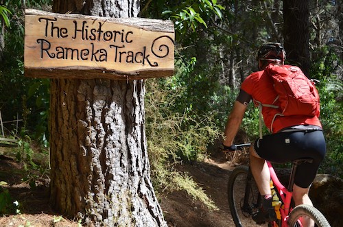
The Rameka Track is a popular walking and cycle track linking Canaan, at the top of the Abel Tasman National Park, and Golden Bay. It was originally built in the 1850s as part of a stock route between Nelson and Golden Bay. The Rameka Creek also starts from the highest peaks of the Pikikiruna Range and drains to the Takaka River. So who was Rameka? As part of our series on place names in the park we have taken an excerpt from author and Project Janszoon director Philip Simpson’s book Down the Bay about the origins of the name – Rameka.
While many places in the park are named after European settlers there appear to be very few places named after Māori people. Rameka Creek and the Rameka Track are exceptions.
Rameka, lived at Taupō pa, and was a significant spokesperson for Ngāti Tama during the land dealings with the Crown in the mid 1800’s. He was a signatory to the deeds of 1855 (Motupipi and Takaka land) and 1856 (Separation Point), as well as the 1863 agreement with Ngāti Rarua over respective boundaries at Te Tai Tapu (Westhaven).
Rameka was named as an original owner of the Nelson Tenths associated with Wakapuaka and Takaka, along with his uncles Manihera Te Whitu and Te Hawera, his aunt Pewa, and his cousin Henare Te Ranga. The Tenths was an agreement to reserve one-tenth of all land purchased by the New Zealand Company for the on-going and future prosperity of its Māori vendors.
These roles gave Rameka a standing and an income so that he was able to claim land along the Takaka River, as well as purchasing land at Kotinga and East Takaka. The creek that bears his name ran through a 20-acre (8 hectare) block of his land to join the Takaka River.

