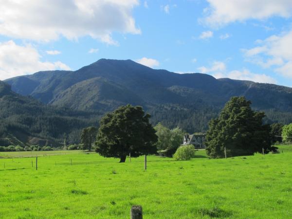
Pikikiruna has given its name to the main range along the western side of the Park, and to the major faultline that has split the NW Nelson mountains to create the Takaka Valley, and to the unique metamorphic (heat-altered) rock, Pikikiruna schist, that forms the highest points along the western range.
At 1065m Pikikiruna Peak is one of the highest points in the Park, just short of nearby Mt Evans (1156m), and the only peak to retain its Maori name. In the earliest European records Pikikiruna, is reported as “Pikeora”. It means, the land that has to be climbed over, in order to get to the Takaka Valley and trails to the West Coast greenstone (pounamu) sources. The peak also forms the southern Park Boundary at the head of Ironstone Creek and is very conspicuous from the Takaka valley.
The word ‘piki’ means to climb or step over and also refers to things close together or confused, an apt term when applied to the contorted physical structure of the Park. The official name Pikikiruna’ is probably a mis-spelling of ‘Pikikirunga’. There is little in the meaning of ‘runa’ that relates to hills such as these, but the word ‘runga’ (a silent ‘g’) does relate. It means the top, or upper part, and with the preposition ‘ki’ means ‘up above’. Pikikirunga is the highest point close to the early Maori track over the hill from the Riwaka River valley. This route was taken by the earliest European explorers, (Heaphy and Brunner), with Maori guides, who used this name. It now applies in a general way to the Takaka Hill


